
New map shows exactly where coronavirus cases are in Waterford

By Justin Kelly
Published 16th Apr 2020, 12:58 BST


A newly released map has revealed the spread of coronavirus across Waterford and across the country.
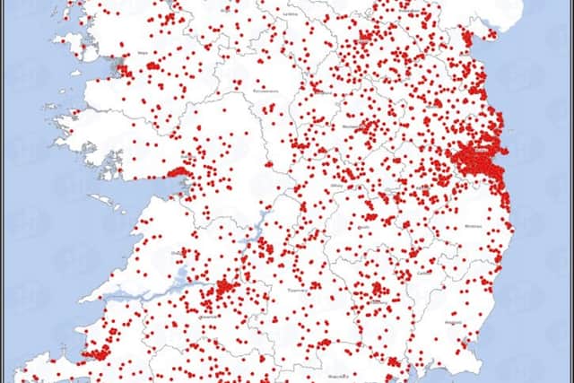
In Waterford, most cases are clustered around the city but there are notable clusters of cases in both Dungarvan and Tramore. Cases in Clonmel too look to have spilled over the border into Waterford.
Most parts of west Waterford are not as badly affected.